|
> |
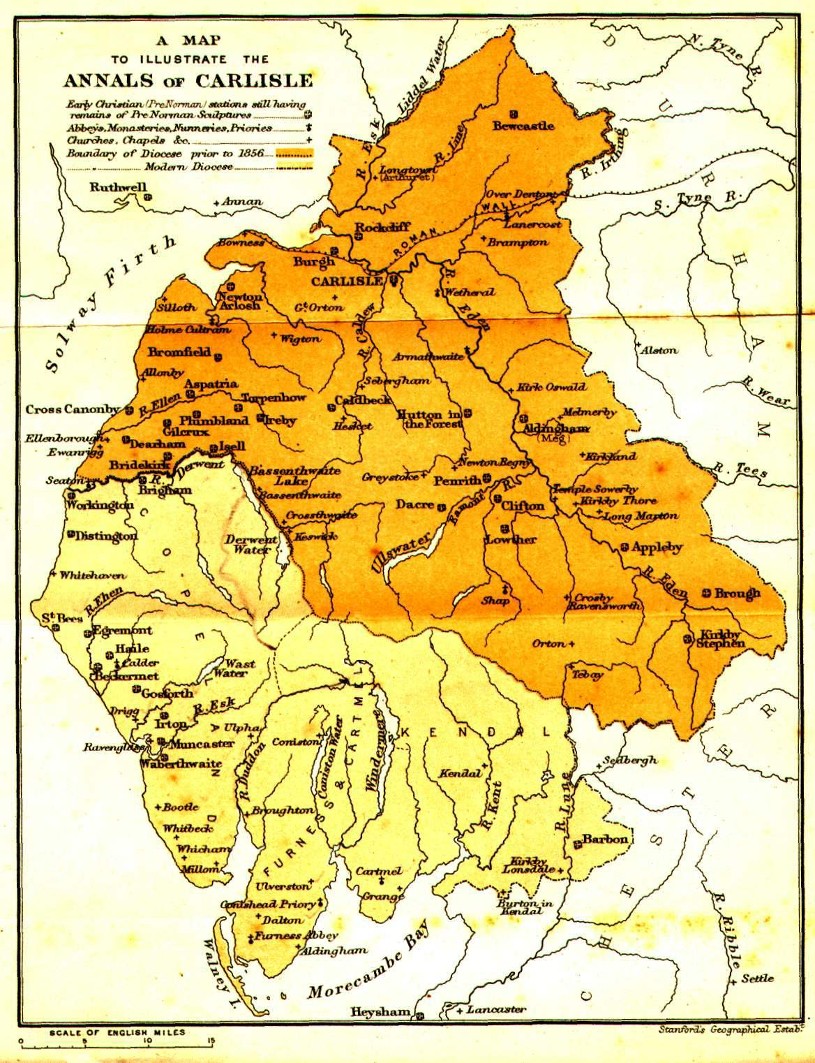
Maps of the Solway, all
from George Neilson's Annals of the Solway until A.D. 1307, published in 1899.
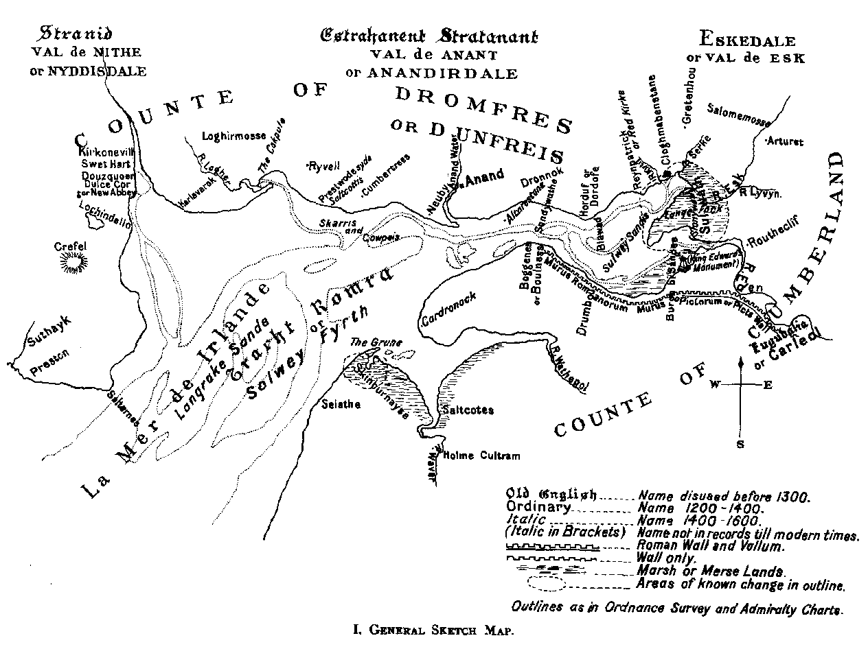
Sketch map showing the Solway.
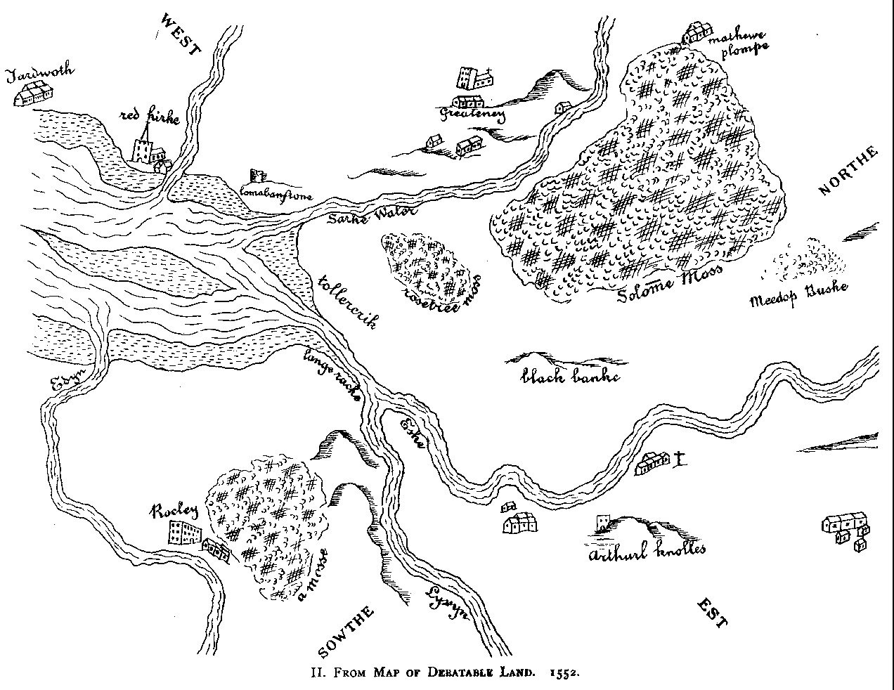
The landward end of the Solway, from a map of the "Debateable Land" dated 1552.
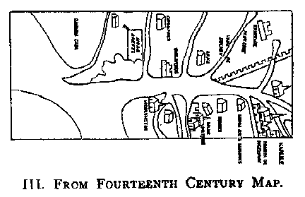
A crude map of the Solway from the 14th century.
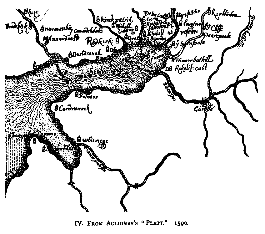
The Solway
from Aglionby's "Platt" of 1590.
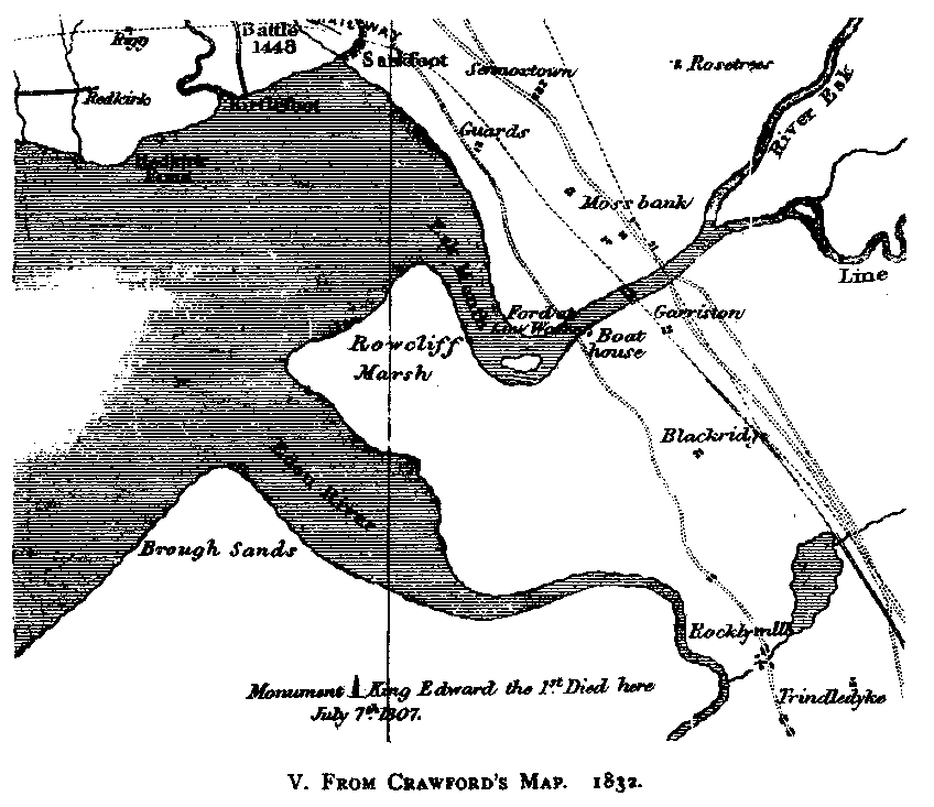
The Solway
from Crawford's map of 1832.
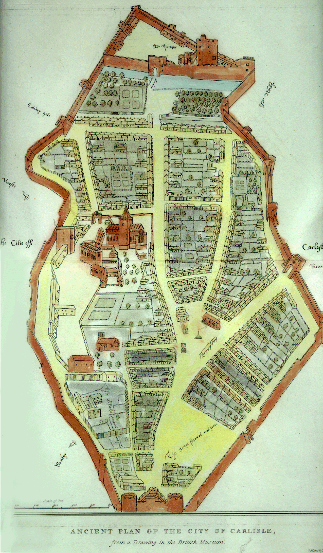
Carlisle
Carlisle,
from Lyson's Magna Britannia, published in 1815, but dating from earlier days.
Map by Cadell & Davies.
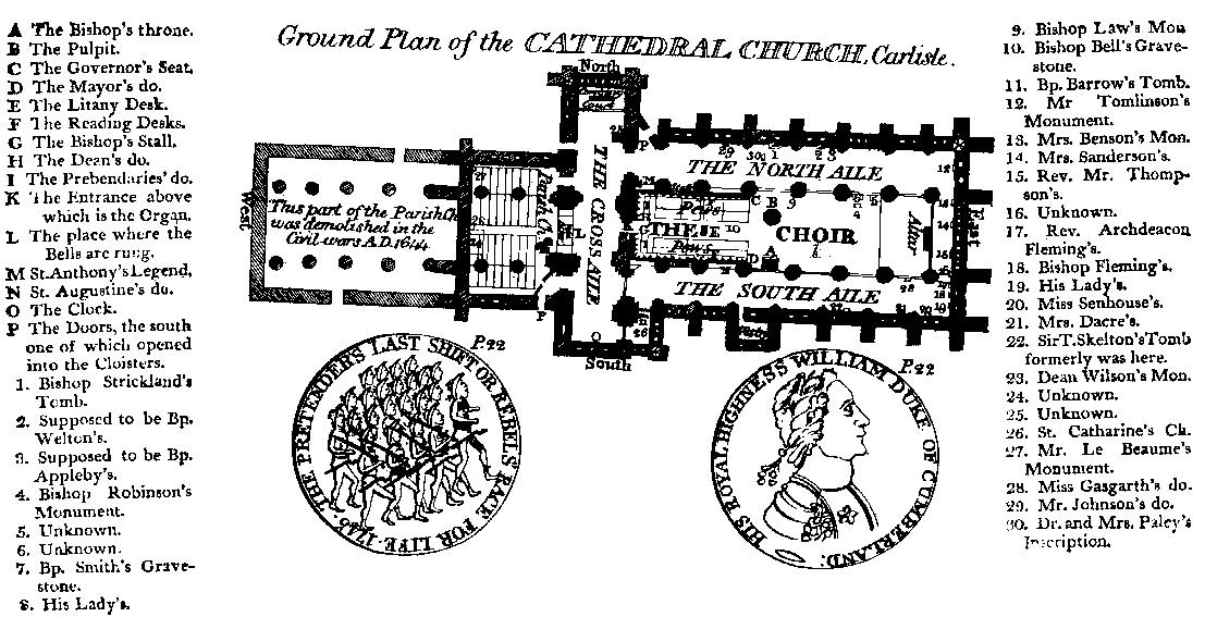
A plan of the cathedral,
from Jollie's Cumberland Guide and Directory 1811.
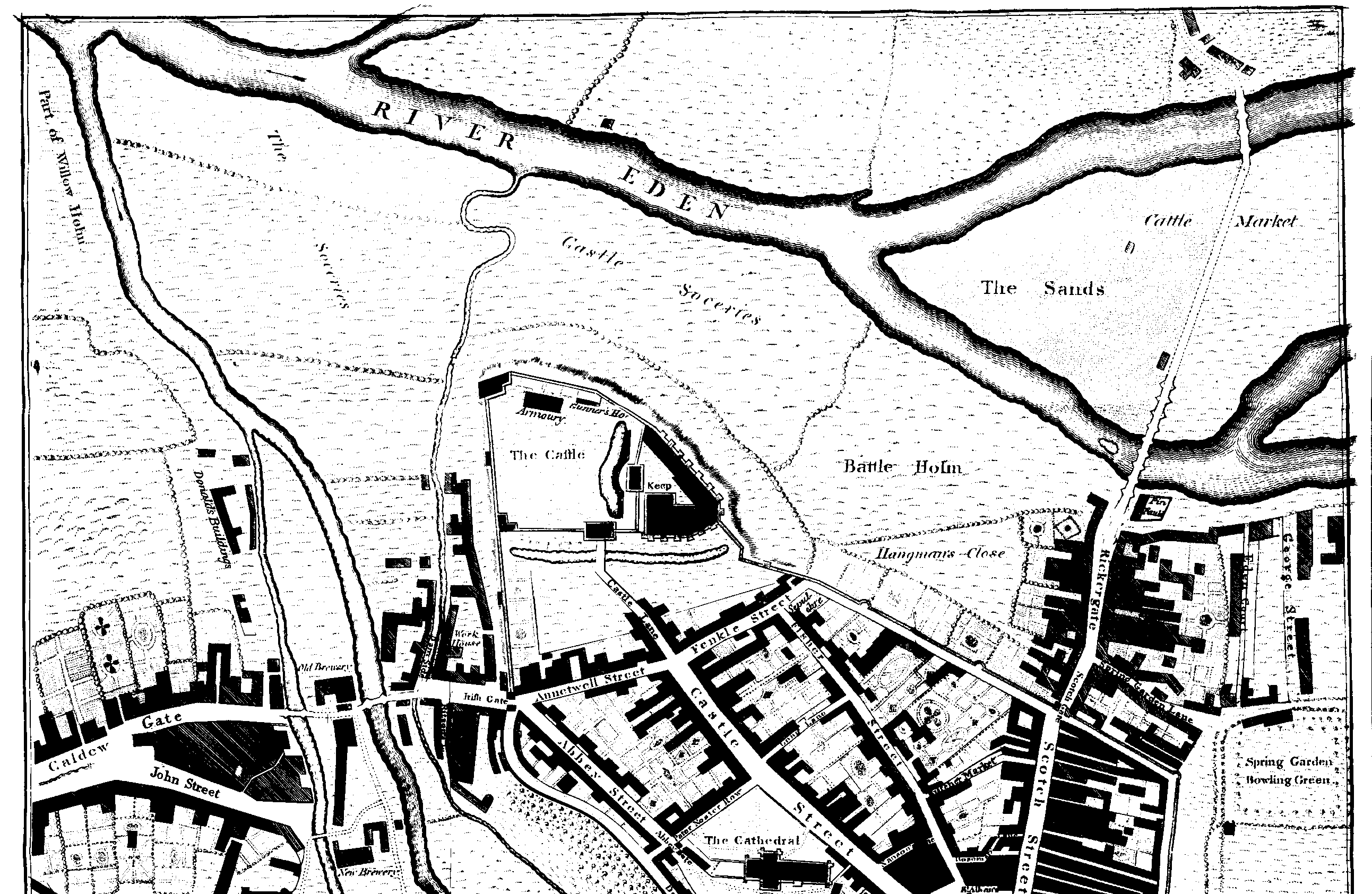
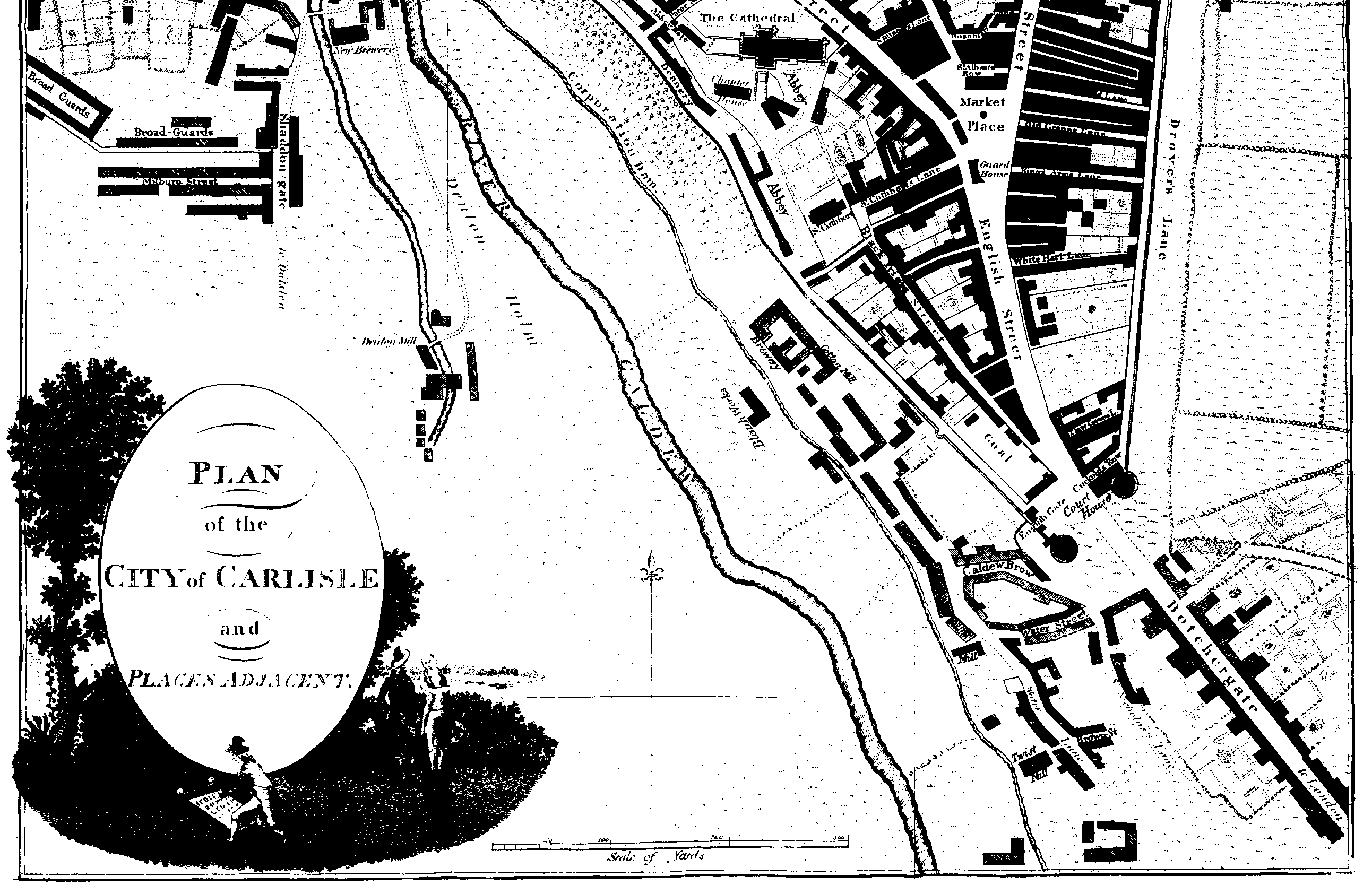
From Jollie's Cumberland Guide &
Directory, 1811. The map of Carlisle is too large to scan in one piece. Accordingly,
there are two overlapping maps, covering the left and right halves. These are rather large, and the suggestion is
made that, once downloaded, you right-click the image and save it to your hard disk.
The National Library of Scotland can
supply a photocopy of Wood's splendid map of Carlisle, dating from 1821, at a cost of
about £5 (including UK postage). They can be contacted at maps@nls.uk.
If contacting them by mail, their address is National Library of Scotland, Map Library,
Causewayside Building, 33 Salisbury Place, Edinburgh, Scotland, EH9 1SL.
Cumbria
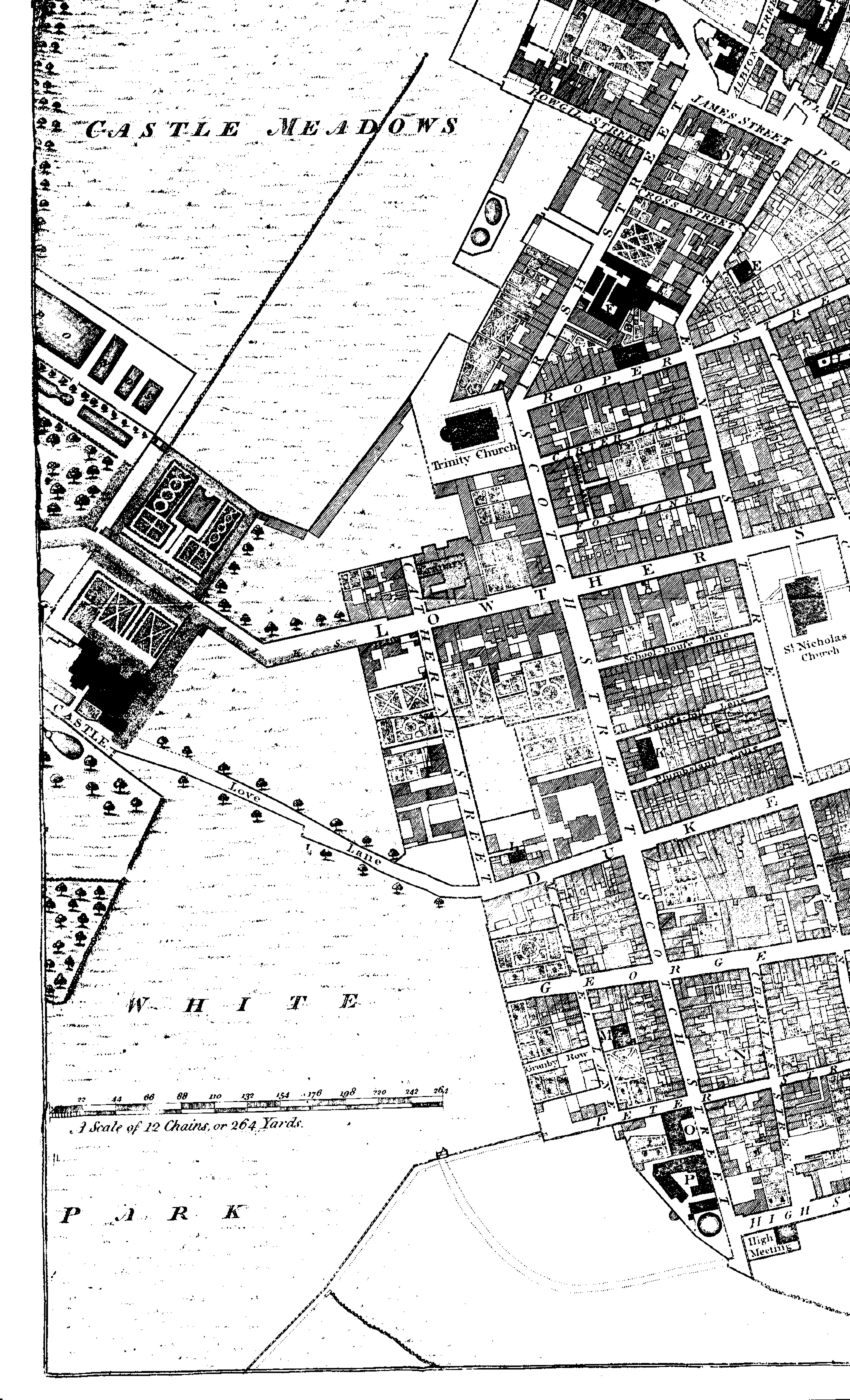
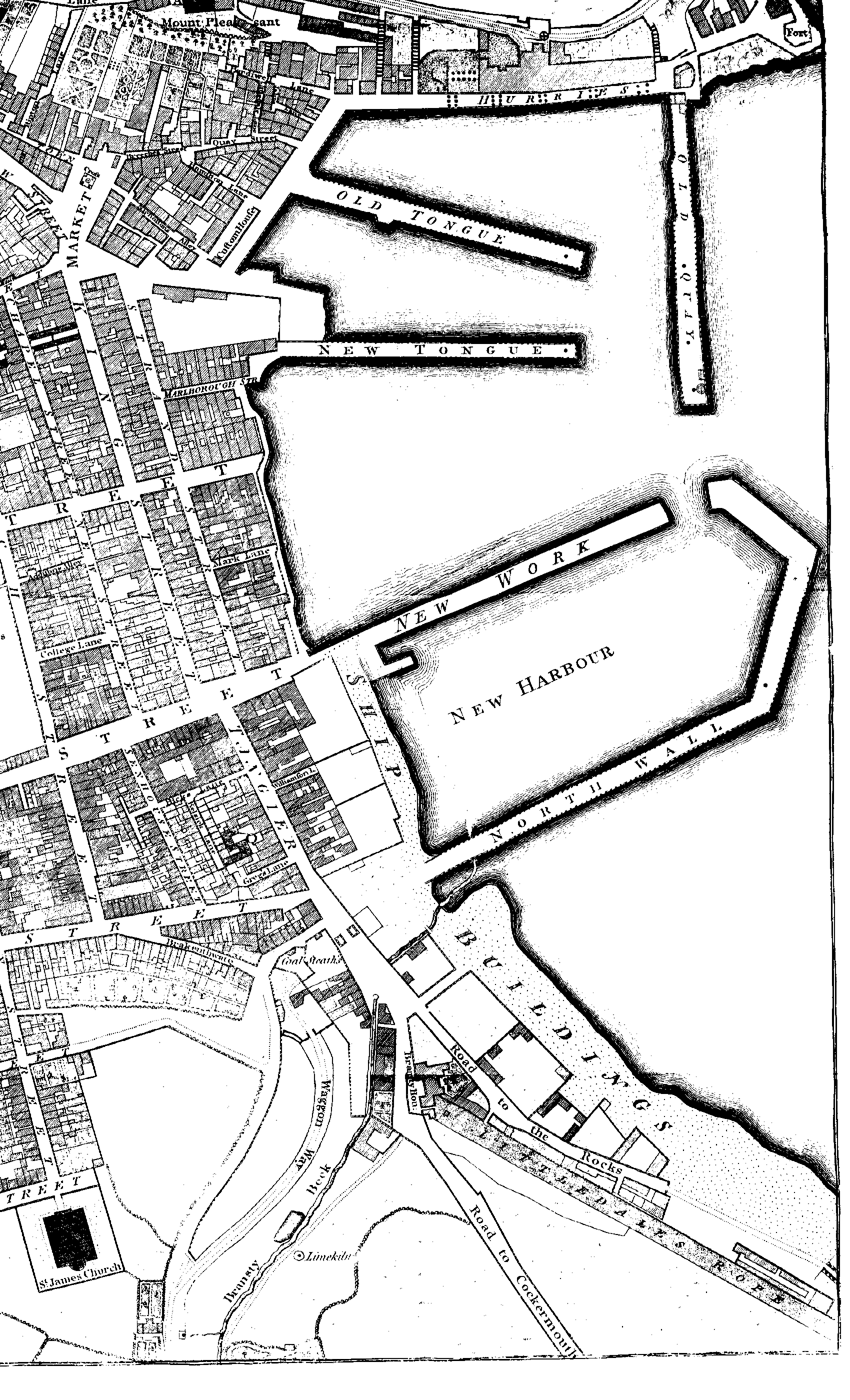
Whitehaven
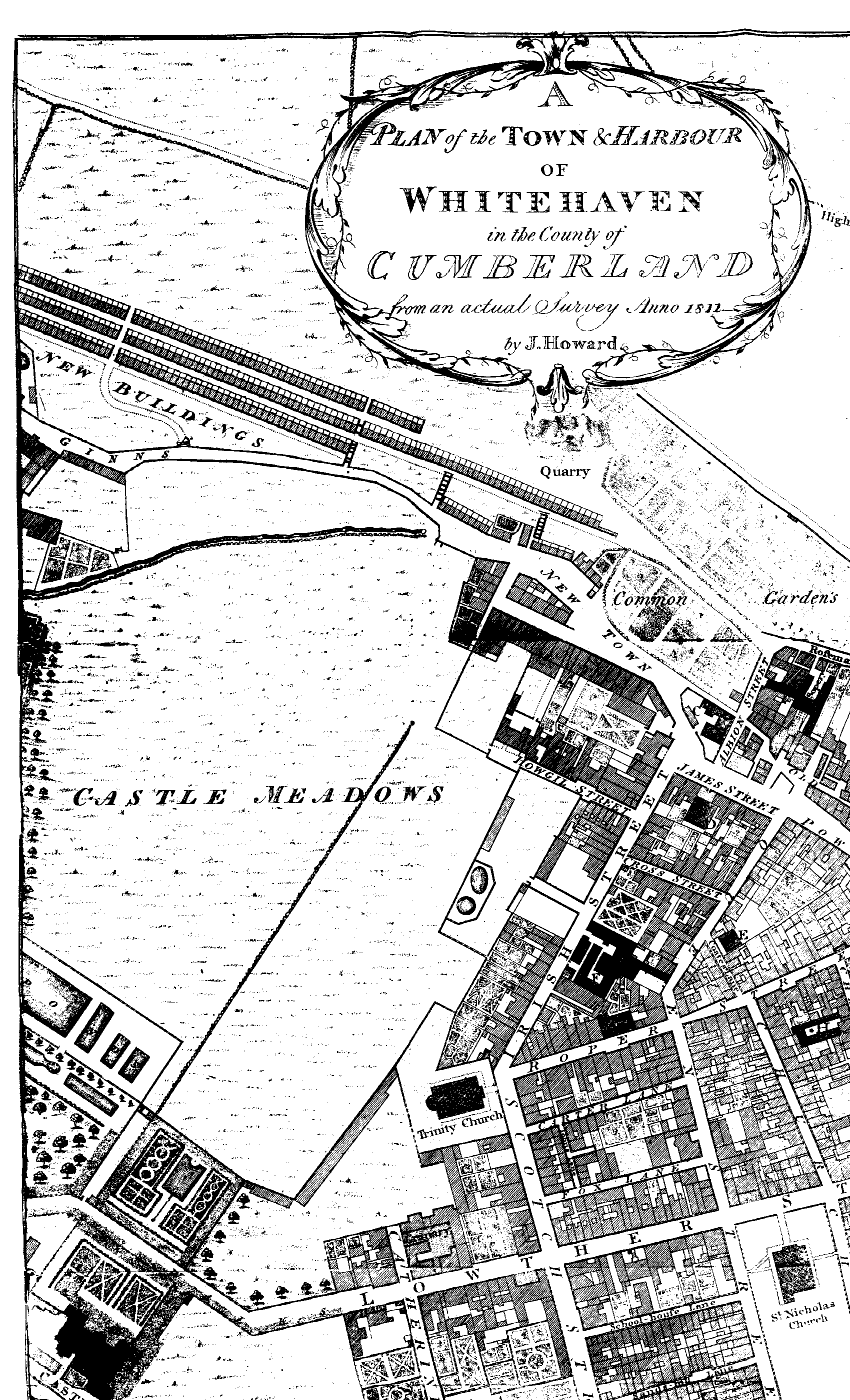
From Jollie's Cumberland Guide &
Directory, 1811. The map of Whitehaven is too large to scan in one piece.
Accordingly, there are four overlapping maps, covering the top-left,
top-right, bottom-left, and bottom-right quarters. These are rather large, and the suggestion
is made that, once downloaded, you right-click the image and save it to your hard disk.
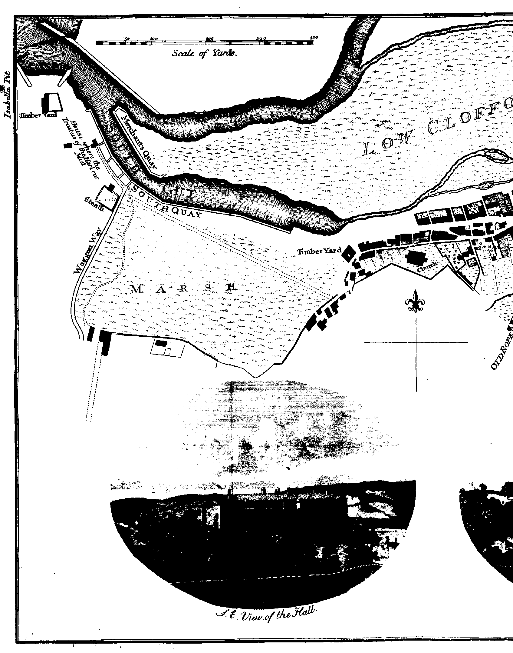
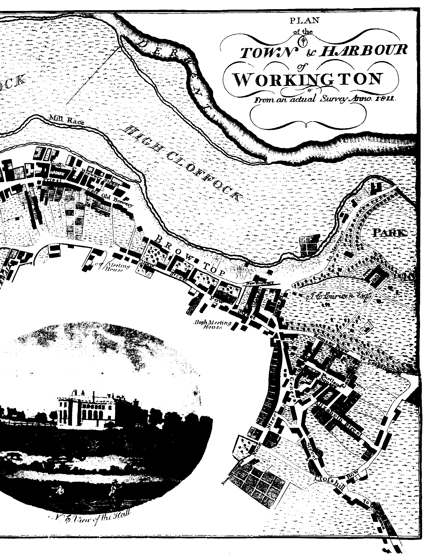
Workington
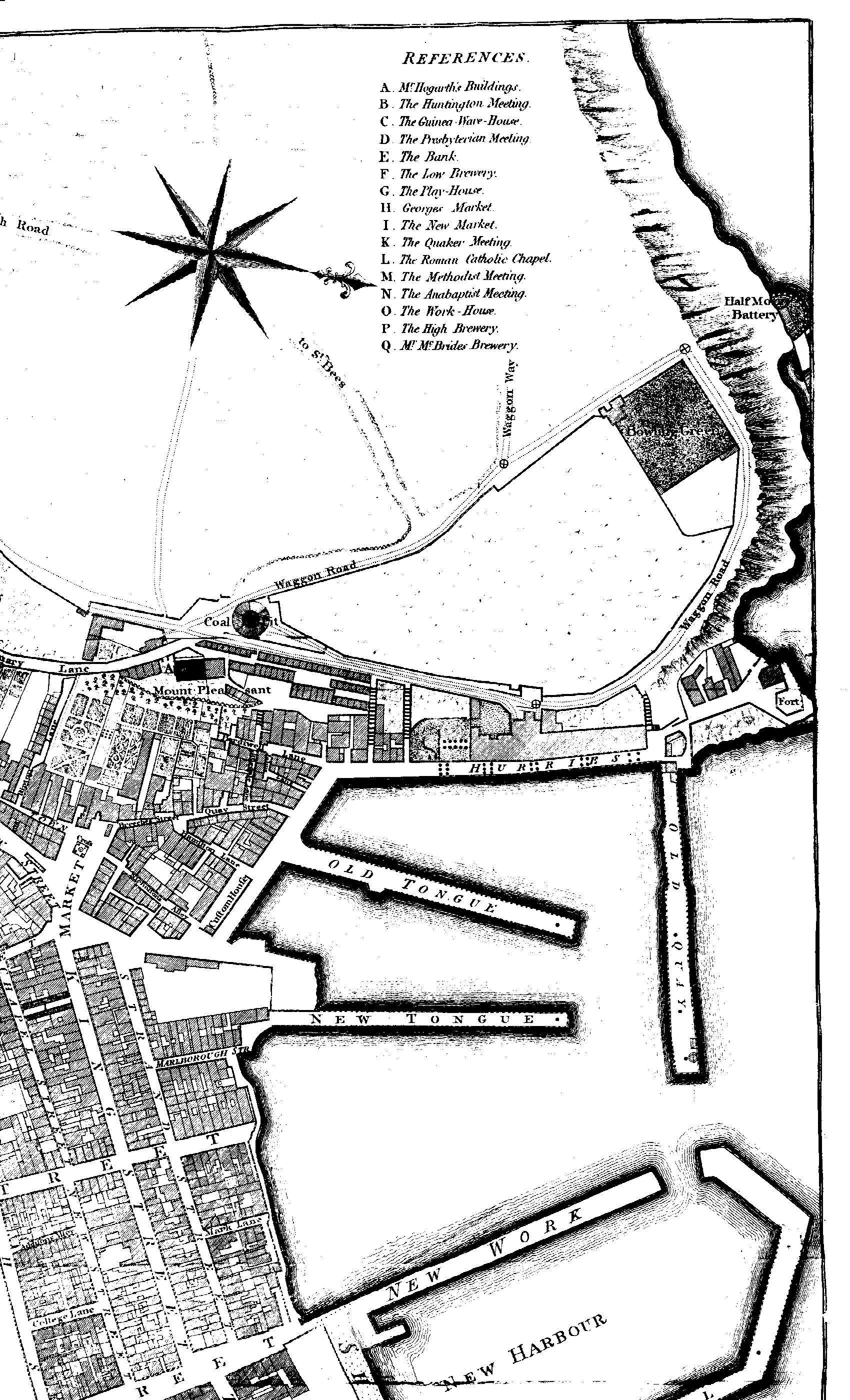
From Jollie's Cumberland Guide &
Directory, 1811. The map of Workington is too large to scan in one piece.
Accordingly, there are two overlapping maps, covering the left
and right halves.
|
> |