 to cold and stormy weather, and is
often severely affected by the helm wind. Many of the
farms here are occupied by their owners, but Wm. Crackenthorp, Esq., of Newbiggin Hall,
Westmorland, is lord of the manor. On the estates of Mr. John Spedding and Mr. Jas.
Shepherd, in the western extremity of the parish, appear vestiges of an ancient British
fort, consisting of an outward and inner rampart, with a ditch between them, and
enclosing a pentagonal area, in which an urn, and many fragments of ruined walls
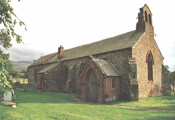
have been found. The Church, which is dedicated to St. Luke, consists of a nave and
chancel, with a bell turret at the western end, carrying two bells. In the chancel is the
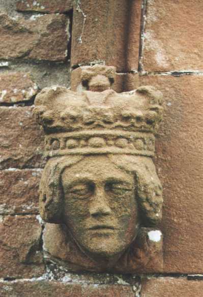
figure of a crusader, cross legged, carved in oak, in mail armour, and in the attitude of
prayer. It is now placed before three stone seats or sedilia, formerly used by the priest,
the deacon, and subdeacon, during part of the service of high mass. On the east side is a
piscina, corresponding with the seats. The bishop of Carlisle is the patron, and the Rev.
John Fenton, M. A., is rector, who resides at the rectory-house, which is a good building,
contiguous to the church. The living is valued in the king's books at £13 13s 4d., but is
now worth £353: the tithes have been commuted for a yearly modus of £315, and there are
about 32 acres of glebe. The Revd. Thomas Robinson, A.B., rector of Ousby, who died in
1719, is well known to the literati by the works he published on the Natural History of
Cumberland and Westmorland, and of "This World of Matter, and this World of
Life."1
to cold and stormy weather, and is
often severely affected by the helm wind. Many of the
farms here are occupied by their owners, but Wm. Crackenthorp, Esq., of Newbiggin Hall,
Westmorland, is lord of the manor. On the estates of Mr. John Spedding and Mr. Jas.
Shepherd, in the western extremity of the parish, appear vestiges of an ancient British
fort, consisting of an outward and inner rampart, with a ditch between them, and
enclosing a pentagonal area, in which an urn, and many fragments of ruined walls
have been found. The Church, which is dedicated to St. Luke, consists of a nave and
chancel, with a bell turret at the western end, carrying two bells. In the chancel is the
figure of a crusader, cross legged, carved in oak, in mail armour, and in the attitude of
prayer. It is now placed before three stone seats or sedilia, formerly used by the priest,
the deacon, and subdeacon, during part of the service of high mass. On the east side is a
piscina, corresponding with the seats. The bishop of Carlisle is the patron, and the Rev.
John Fenton, M. A., is rector, who resides at the rectory-house, which is a good building,
contiguous to the church. The living is valued in the king's books at £13 13s 4d., but is
now worth £353: the tithes have been commuted for a yearly modus of £315, and there are
about 32 acres of glebe. The Revd. Thomas Robinson, A.B., rector of Ousby, who died in
1719, is well known to the literati by the works he published on the Natural History of
Cumberland and Westmorland, and of "This World of Matter, and this World of
Life."1
Mannix & Whellan, History, Gazetteer and Directory of Cumberland, 1847